
Richardson Neighbors by Block
A block search works best as a series of narrow record checks. Start with the city parcel map to establish geometry and site addresses. Then choose Dallas Central Appraisal District or Collin Central Appraisal District from the parcel’s county, not merely the Richardson mailing line. County deed and plat records can explain a transfer or lot relationship. A city permit inquiry can show an address-linked application or project. Voter records and neighborhood groups have more limited roles. Each source describes one part of the block rather than a complete list of people.
| Source | What It Shows About a Block | Access |
|---|---|---|
| Richardson GIS and ArcGIS parcels | Parcel geometry, site address, owner and year-built fields, plus adjoining polygons | Public map and service; verify against CAD and deed records |
| DCAD or CCAD | Parcel owner, legal description, tax context, situs and mailing fields | Public searches selected by county |
| Dallas or Collin deed and plat index | Transfers, recorded legal parties, and lot or block relationships | Online index plus clerk copy channels |
| Richardson permit inquiry | Address-linked application and project evidence | Public inquiry; narrow searches can reach a 100-result cap |
| Texas My Voter Portal | Individual registration and polling context within display rules | Individual lookup; protected fields omitted |
| Neighborhood associations | Civic boundaries, public contacts, and community context | City inventory; membership directories are not guaranteed |
| Library reverse directories | Dated address and telephone relationships from historical sources | Local-history and licensed-resource channels |
An owner field is not proof of present occupancy. A mailing address can be elsewhere, a parcel can be held by a trust or entity, and a condominium layer can show only the first owner. Treat a public result as a recorded fact at a time, then confirm it with the appropriate custodian if the distinction matters.
Map Richardson Neighbor Parcels
Richardson’s official GIS materials make the parcel layer a useful first screen for a block. The city feature layer is derived from DCAD and CCAD data and updated monthly. It exposes site address, owner, and year-built fields along with parcel geometry. Its public service supports GIS-oriented query formats, but it is not a deed-index search. A service maximum also means the map should be used one parcel at a time rather than as a broad block export.
Richardson’s parcel ArcGIS service is the source of this GIS capture.
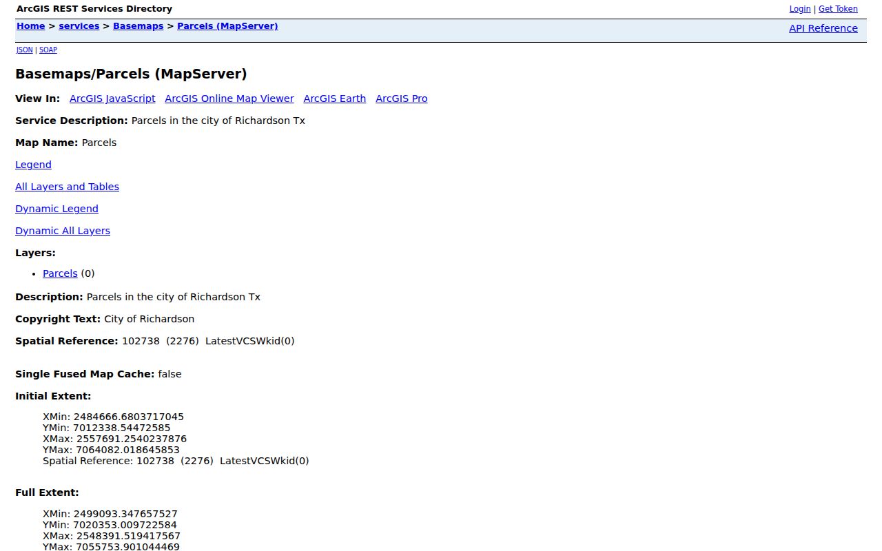
The service identifies the parcel layer and its map-query context. The next check belongs in the relevant county appraisal or deed record, where legal description and instrument details can be reviewed.
The adjacent-parcel flow is simple: known address → target parcel on the map → adjoining polygon → parcel ID and site address → correct CAD record → county deed or plat index. Center the known address, zoom until boundaries and labels are clear, click the target, then click the polygons that physically touch it. Record each parcel ID, site address, and legal description separately. The inspected public service did not show a dedicated radius, buffer, or “neighbors” button, so this flow relies on visible adjoining parcels only.
Richardson Parcel Cards Near You
After the map identifies a parcel, check the county record that governs it. Collin CAD supports owner, street, property ID, geographic ID, subdivision, block, lot, legal description, city, and tax-year searches. Dallas CAD is the parallel route for the Dallas side, although its exact rendered field order was not captured in the research. The city feature layer may also flag a replatted parcel as CAD PENDING. A common element, alley, public tract, commercial parcel, or condominium record can look adjacent without representing a separate household.
Richardson’s parcel feature layer is the source of this captured field view.
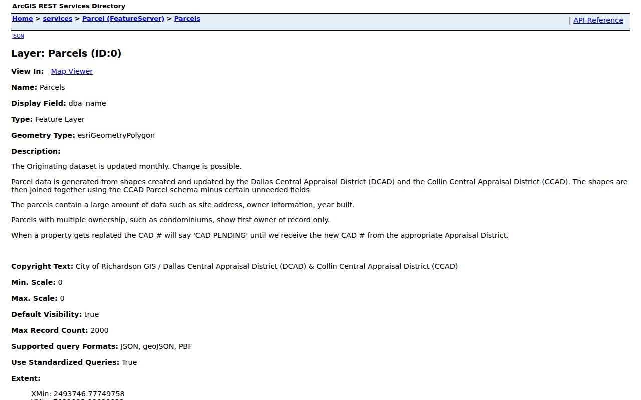
The mapped fields make a good handoff to the CAD record, but the county index and the recorded instrument remain the better sources for a legal transfer or a changed lot description.
- Parcel
- A mapped unit of land used by the appraisal and tax system. Its boundary helps identify a property record.
- Situs address
- The physical location of a property. It is different from a mailing address for tax correspondence.
- Legal description
- The subdivision, lot, block, tract, or metes-and-bounds identity used to connect a parcel to deeds and plats.
- Plat
- A recorded map that lays out lots, blocks, streets, or a replat relationship in a subdivision.
Richardson Neighbors Cross Counties
Richardson’s city limits cross Dallas and Collin counties. That geography is the first practical decision for a block inquiry. The county controls the appraisal district, clerk’s land index, tax route, and district-court record route. A city GIS layer can put adjacent polygons in view, yet each one still needs its own county check. Do not infer the county from a shared street name, nearby ZIP, or a mailing label.
For a Collin-side parcel, use CCAD’s legal description and the county clerk’s current or historical land-record route. Collin instructions direct 1843 through 1975 research to Historical Records. For a Dallas-side parcel, Dallas County Official Public Records describes its real-estate digitization as reaching from 1846 to current records, while some older material can still require Central Records, a counter, or microfilm. The legal description bridges a changed address, replat, or former street name better than a street number alone.
Note: Geographic adjacency is a map fact, not proof that two parcels share the same county, owner, community group, or social relationship.
Voter Rules for Richardson Neighbors
Texas My Voter Portal is an individual search that uses name, date of birth, ZIP, and county. It can return permitted registration, precinct, district, and polling information for a matching person. It does not provide a browse of all voters along a block, and it does not show ballot choices. A public voter record is not a census of every person connected to an address.
A lawful voter-file request is a different channel. The Texas SOS request form requires requester information, a product or record selection, an affidavit or use conditions, and a fee. Some voter fields are public in the state framework, while Social Security, driver-license, personal-ID, and protected-address information are confidential. A protected voter or Address Confidentiality Program participant may not appear at a residential address in ordinary public display.
Richardson Neighborhood Contacts
Richardson’s official neighborhood-association inventory lists approximately 75 groups. Boundaries are self-determined, participation and dues are voluntary, and the city does not present the listing as a private member roster. An association can include homeowners, residents, apartment dwellers, businesses, churches, and schools. That makes the inventory useful for civic geography, meeting context, and public contact routes, but not for determining who belongs to a particular address.
| Association reference | Public context | Contact route |
|---|---|---|
| Canyon Creek | Listed in the city’s neighborhood-association inventory | Verify current boundary and public contact through the city listing |
| Cottonwood | Listed in the city’s neighborhood-association inventory | Use the city listing for the current public association route |
| Richardson Heights | Listed in the city’s neighborhood-association inventory | Confirm current contact and voluntary participation with the city route |
| University Estates North | Listed in the city’s neighborhood-association inventory | Check the city inventory before relying on an older contact |
Richardson’s neighborhood-association inventory is the official starting point for these public civic contacts. The city’s neighborhood-resources program also supports new groups and asks for a group name, address, phone, and area when a group registers its information. Staff response is described as within two business days.
Richardson Block Permit Clues
The Richardson permit inquiry is address-keyed. It can be searched by application year and number, or by street number, street name, and direction. A street-number-only search can return up to 100 matches, so add as much address detail as the form permits. A permit can be useful for placing a construction, addition, reroofing, or remodel event in time. It is not a title record, and the named party may be an applicant, contractor, or owner rather than the person present at the address.
Use a permit date as one dated point in a block chronology. Pair it with a CAD record, a deed or plat, and a historical directory or newspaper when the goal is to understand a past address. For the broader current address chain along a named street, the Richardson street directory focuses on street-by-street records.
Richardson Neighbors: Official Sources
Official records are narrow by design. They identify a parcel, recorded legal interest, case, civic boundary, or individual registration fact within a custodian’s rules. Commercial neighbor-lookup categories may combine property, directory, court, and marketing fragments, but those results can be stale, merged, or disconnected from the source record. A subscription result should never replace a county clerk, appraisal district, city GIS layer, or election custodian when an important fact needs checking.
| Record category | Strength | Limit |
|---|---|---|
| Official parcel, CAD, deed, or plat record | Shows a dated legal or mapped fact from its custodian | Does not establish every person at the address |
| Official voter or civic record | Shows permitted individual or community context | Protected fields and private membership information stay restricted |
| Commercial compiled record category | May provide a lead to verify | Can be stale, merged, inaccurate, or missing its original context |
When a compiled entry is wrong, keep the profile reference and correction confirmation, then ask the original public-record custodian to correct its record if the underlying entry is inaccurate. Texas privacy rights do not automatically remove a county deed, court docket, CAD parcel, voter record, or vital record.
Privacy Limits for Richardson Neighbors
Private household members, utility data, delivery data, motor-vehicle personal data, protected voters, and Address Confidentiality Program addresses do not become a block record because nearby parcels are visible. A deed shows a recorded transaction, not current presence. A voter lookup establishes limited registration context, not a person’s ballot choices. City permit and code material can identify an address event without identifying who is present there.
Texas address-confidentiality rules protect qualifying people who use substitute addresses, and other protected categories can have information withheld under specific statutes. Recorded images can also contain sensitive material that should not be copied into a profile or republished. Respect a restricted result, use the custodian’s correction or redaction route when appropriate, and collect only the detail needed for a lawful question.
Lawful use. Use block records for personal research, civic context, or neighborhood curiosity. Texas Penal Code §42.074 prohibits harmful online disclosure of a residence address or telephone number, and records must never be used to stalk, harass, or intimidate anyone.