
Trace a Richardson Street Directory
A street-by-street search begins by locating the parcel, not by treating a road name as a county boundary. Richardson spans Dallas County and Collin County, and the same city name can lead to different appraisal districts, clerk indexes, tax offices, and courts. The parcel card supplies the situs address, the physical location, and the legal description used in recorded land documents. Keep the legal description with every search. A tax mailing address can be useful context, but it is not proof that its recipient lives at the situs address.
- Use the address in the applicable appraisal district or parcel map. Save the parcel or geographic identifier, current listed owner, and legal description.
- Open the Richardson GIS layer and compare the target parcel with the parcels beside it. Record the map context without treating adjacent geometry as proof of a social connection.
- Search the correct county clerk index for the owner or legal description. The most recent instrument supplies grantor, grantee, recording details, and document type.
- For an individual voter-status question, use Texas My Voter Portal with the required personal fields. It is not a public street-browse tool.
- For a dated household clue, check old phone books or reverse material through the Richardson Public Library and compare it with the deed and map timeline.
Each step answers a narrower question. The chain is strongest when the address, legal description, county, and date agree.
Richardson Street Records Split by County
Dallas and Collin records must be kept separate from the first search. A Dallas-side parcel may lead to the Dallas Central Appraisal District and the Dallas County Clerk Recording Division. A Collin-side parcel can lead to Collin Central Appraisal District, then Collin County Clerk Land Recordings. The city name on an envelope does not settle that question. Use the parcel result, legal description, or appraisal-district record before selecting an index.
This geographic split is a useful safeguard for family research, estate questions, and checking a suspicious property notice. Dallas describes its real-estate records as digitized from 1846 to current, though image access and historical channels can vary. Collin separates its current land search from an Historical Records route for 1843 through 1975. A missing online result can point to the wrong county or the wrong historical channel, rather than proving a transfer never occurred.
Note: A Richardson mailing line alone does not tell you which county clerk or appraisal district holds the parcel record.
Richardson Address Fields at Collin CAD
For a Collin-side address, the Collin Central Appraisal District search offers both owner and advanced paths. Street Number and Street Name are especially useful for a by-address search. The current form also exposes Property ID, Geographic ID, Subdivision, Neighborhood, Tax Year, and Legal Description. Its instructions distinguish the street name from prefix, suffix, and unit information, so a search may need to be simplified before it returns a parcel.
| Collin CAD field | How it helps a street search |
|---|---|
| Street Number | Finds the numeric part of a situs address. |
| Street Name | Searches the road name without prefix, suffix, or unit numbers. |
| Property ID or Geographic ID | Preserves a parcel identifier for later map and deed work. |
| Subdivision and Legal Description | Connects the street address to lot, block, or other deed language. |
| Tax Year and Neighborhood | Adds time and local map context to the parcel result. |
Dallas Central Appraisal District is the parallel route for Dallas-side Richardson parcels. Detailed Dallas search-field claims were not available in the researched official material, so verify its live interface before relying on a particular filter. Once a parcel produces a legal description, that description is a more durable bridge into the county deed index than a street name alone.
Map Richardson Parcels Along a Street
Richardson GIS provides the city’s map context for a road, its parcels, zoning, districts, and nearby boundaries. The public parcel feature layer is generated from Dallas and Collin appraisal data and is updated monthly. Its exposed fields include a site address, owner, and year built. Those attributes are useful leads, but a condominium can show the first owner and a replatted property can carry a CAD PENDING note. Verify important details against the applicable appraisal district and deed.
The Richardson parcel service is shown below as the city’s map and query entry point.
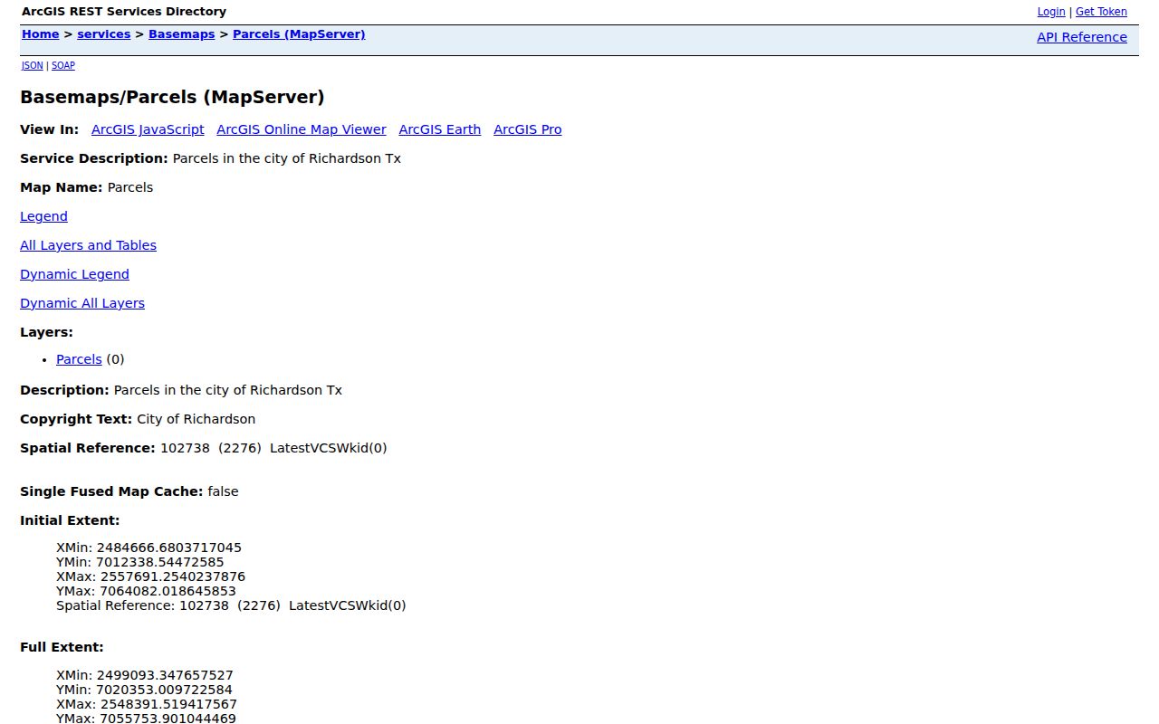
Use the layer to click the target parcel, then inspect adjoining polygons one at a time. The map’s public service limit and its GIS-oriented query tools make it a parcel context source, not a complete resident listing.
A second Richardson parcel feature-layer view shows the CAD-derived field model used for map work.
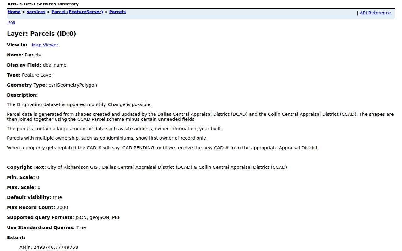
Adjacent parcels can be visually browsed, but the map does not offer a verified public control that lists every person on a street.
Follow a Richardson Address Through Deeds
A recorded deed is organized around parties and legal land language, not a current household list. In the Dallas County Official Records advanced search, Party Names, Grantor, Grantee, recorded and instrument dates, document numbers, lot, block, and legal-description filters can narrow an address trail. Party names are entered surname first, and dates use MM/DD/YYYY. Read the instrument type before deciding what the parties’ names mean.
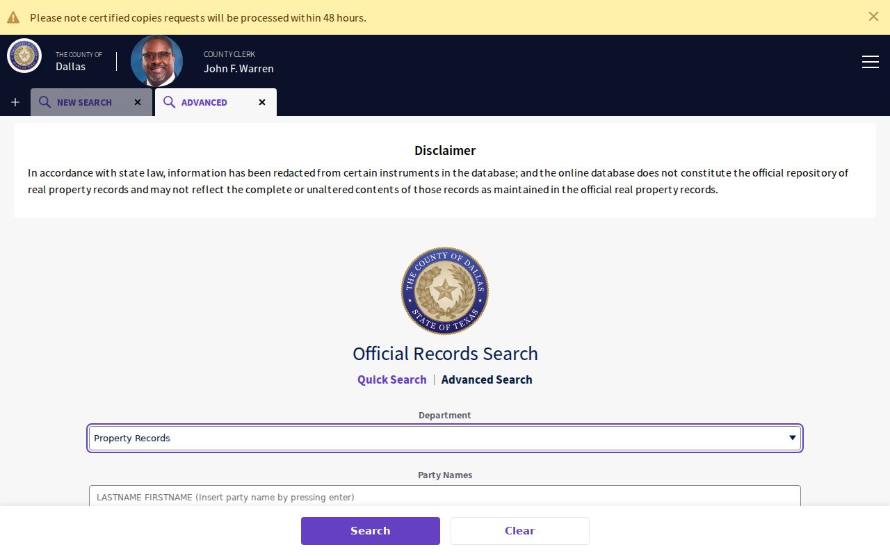
Start with the current listed owner as a grantee or party, copy the legal description from the purchase instrument, then look for the earlier purchase by searching the prior grantor as a grantee. If a replat changed a lot or block, follow the plat and recorded references instead of forcing a modern address into an older index.
Collin County’s online land instructions call for a name or document-number search, use of the CCAD legal description, sorting by recorded date, and a separate Historical Records path for 1843 through 1975. Dallas offers a counter, central-records, and mail-copy route when a record family is not available in the expected online channel.
Read Richardson Permit Clues by Address
The Richardson permit inquiry is another address-keyed source. It can search by application year and application number, by street number, street name, and direction, or by permit PIN number. The location search supports partial contains matching, but a street-number-only query can reach the portal’s 100-result cap. Narrowing the street name makes the result set more useful.
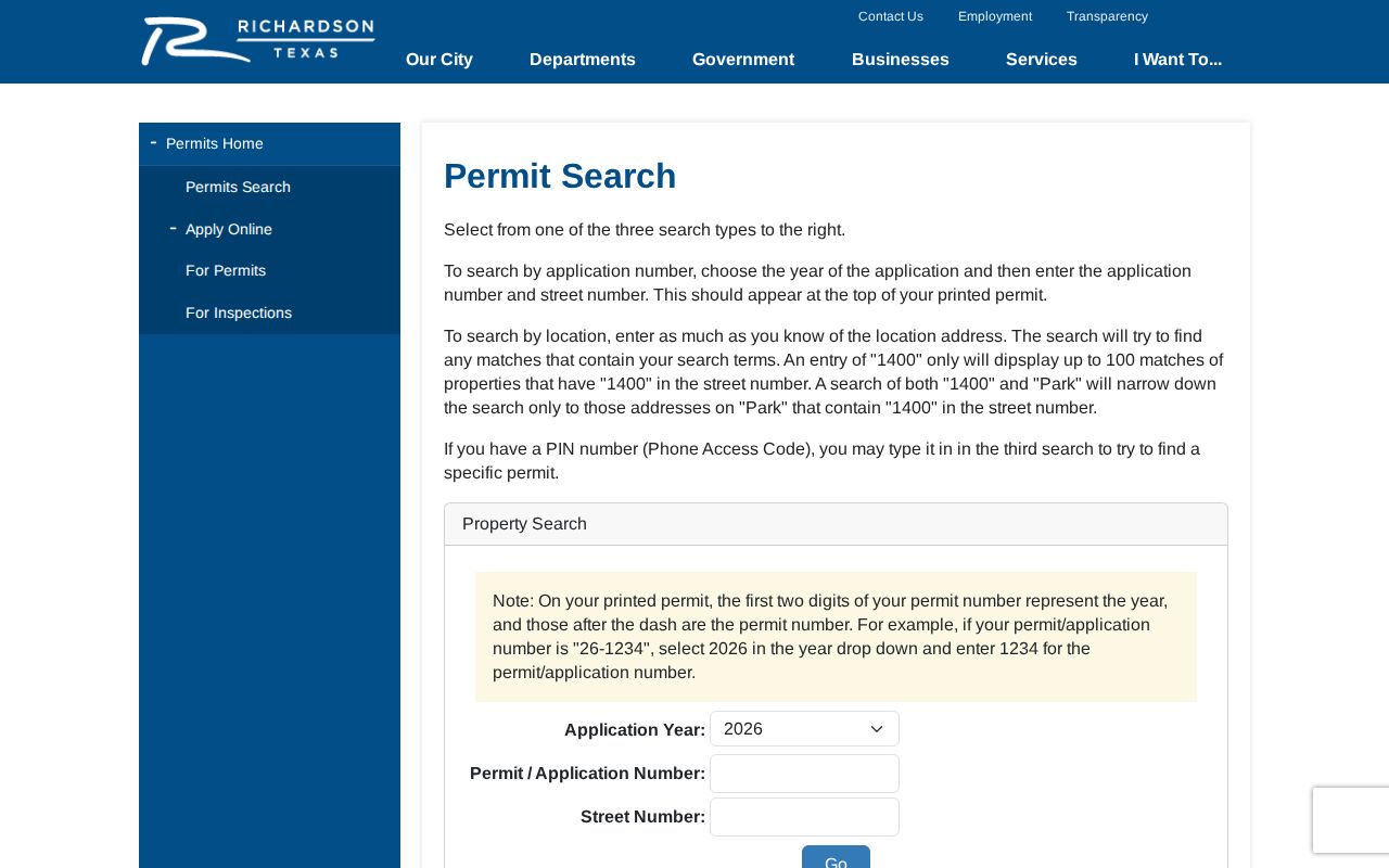
A permit is evidence of a work or application event at an address. It may name an applicant, contractor, or owner depending on the record, and it does not establish who lived there. Treat the permit date as a point on the property timeline, then compare it with the parcel and deed dates.
Note: The researched material does not provide a historical cutoff for the permit portal, so do not assume it is a complete construction archive.
Use Richardson Voter Records Carefully
Texas My Voter Portal is designed for an individual lookup using name, date of birth, ZIP code, and county. For Richardson, the county selection can be Dallas or Collin. A match may show registration status and permitted address, precinct, district, or polling information. It does not show ballot choices, and a no-match can result from spelling, county, date-of-birth, or address-change differences.
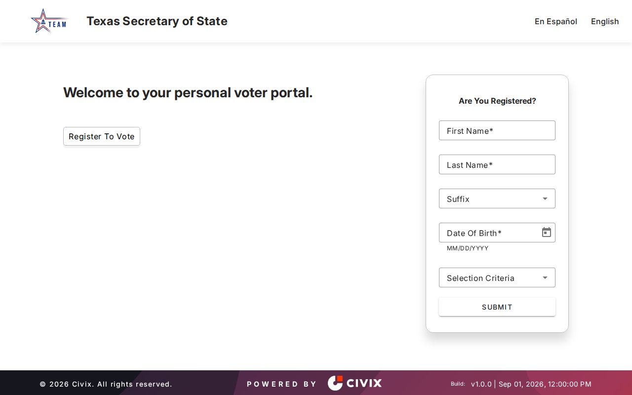
The public lookup is not an open way to browse a street. A voter-file request follows a separate lawful request and affidavit process, and protected address information remains confidential. Use the individual tool only for the limited question it is built to answer.
Match Richardson Streets Across Time
Older records often need a historical-name check before the address trail makes sense. The city’s documented bridges include Smith Street, now East Main, and Richardson Pike, now Greenville Avenue. These are useful paired searches for old deeds, newspapers, and directories. No official citywide street-renumbering date was verified, so an address change should be tested with plats, legal descriptions, nearby cross streets, and the historical city sources rather than assumed to represent a different parcel.
Richardson Public Library holds old phone books and local-history material, while the 1974 Greater Dallas white-pages scan supplies dated Richardson name, address, and telephone clues. The historical volumes themselves are described on the Richardson Directory Book page. A dated directory clue needs support from a deed, census, newspaper, or later listing before it is treated as a household conclusion.
Compare Richardson Street Record Types
Address-keyed records have different roles. Combining them gives a fuller street picture while preserving the limits of each source. The table below separates the person or property connection each record can support from the access route that the research documented.
| Address record | Richardson keeper | Useful connection | Access route |
|---|---|---|---|
| Parcel card | Dallas CAD or Collin CAD | Owner, situs and mailing address, legal description, parcel references | Public appraisal search by county |
| GIS parcel | City of Richardson GIS | Parcel geometry, site address, owner/year-built fields, district context | Public map and feature service |
| Recorded instrument | Dallas or Collin County Clerk | Grantor, grantee, recording date, legal description, document type | Online index, historical route, counter, or copy request |
| Permit history | City of Richardson | Application or work event tied to an address | Public permit inquiry |
| Historical phone or reverse listing | Richardson Public Library and digitized collections | Dated name, address, and telephone clue | Library, licensed resource, or public scan |
The street name links the inquiry, but the parcel ID and legal description keep the record trail precise when roads, lots, or city geography changed.
Richardson Address Record Terms
Four terms keep a Richardson street directory search from blending different kinds of evidence. Write each one down exactly as the agency displays it. That small habit makes a return visit to the CAD, GIS, county clerk, or library much easier.
- Parcel
- A defined piece of land in an appraisal or GIS system, usually tied to an identifier and legal description.
- Situs address
- The physical location of the property. It is different from the address used for tax mail.
- Plat
- A recorded map that lays out a subdivision, lot, block, streets, or a replat change.
- Criss-cross directory
- An address-oriented directory section that can connect a street address to a dated listing when one is available.
These labels do not prove the same thing. A parcel anchors land, a plat explains its layout, and a historical listing supplies a dated lead about an address.
Address-Search Limits in Richardson
Public property ownership does not identify every person connected to an address. Parcel and deed records do not establish current occupancy. The researched public sources do not provide utility customer lists or delivery records as address directories. Motor-vehicle address data is restricted, and protected voters or Address Confidentiality Program participants may not appear at a residential address. A permit or map entry also remains evidence of its own event, not a complete household record.
Texas Penal Code section 42.074 restricts harmful electronic disclosure of a person’s residence address or telephone number. Keep notes private, request only records you need, and verify an important fact with the office that created it.